I checked the whole bush. Only one I can see and the only one I’ve ever seen. Do you see what I see?

She liked the rain.

I checked the whole bush. Only one I can see and the only one I’ve ever seen. Do you see what I see?
She liked the rain.
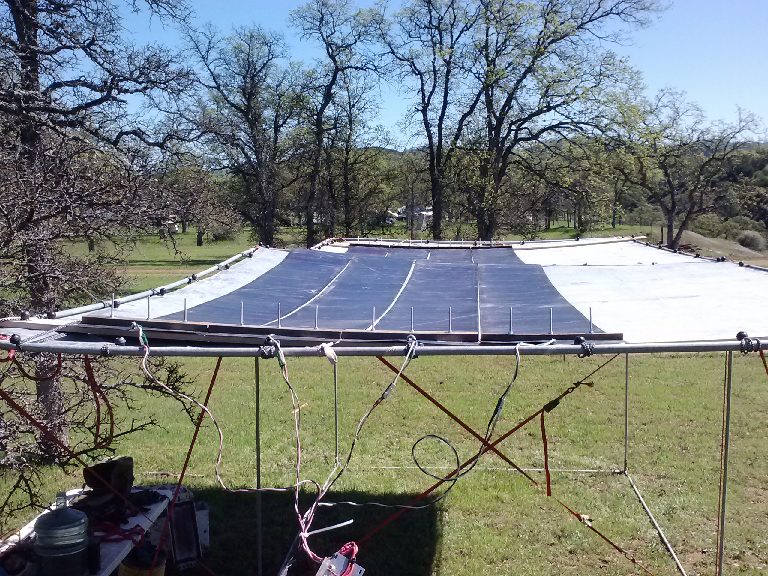
deployed the solar to power the DC3-reloaded for the pagan bunny burn 2016. good test of the setup, find things like shorter bolts are needed, weatherproof the quick-connects, the usual stuffs. some videos up on the tubez. fire pattern and lightning pattern and a close up of the crystal in magnetic suspension emitting polarized chernykov glow.

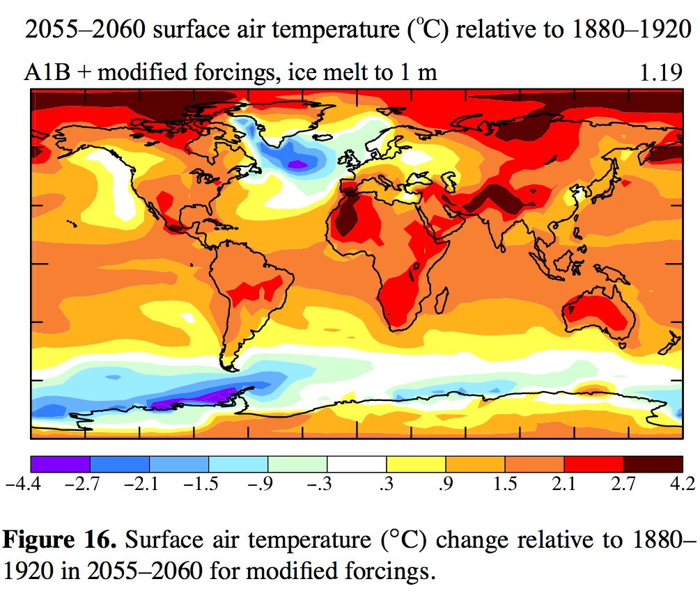
nice little bit of reading here on the climate change thing. i’ve said what Carl said, we’re doomed. this paper says 2055 gets interesting. NE conus and western europe get the big storms. excellent simulations with and without ice melt, etc. in sum: the hotter we make the planet, the bigger the storms will get. in science-speak,
Increased baroclinicity produced by a stronger tempera- ture gradient provides energy for more severe weather events. Many of the most significant and devastating storms in east- ern North America and western Europe, popularly known as superstorms, have been winter cyclonic storms, though sometimes occurring in late fall or early spring, that gener- ate near-hurricane-force winds and often large amounts of snowfall (Chapter 11, Hansen, 2009). Continued warming of low-latitude oceans in coming decades will provide a larger water vapor repository that can strengthen such storms. If this tropical warming is combined with a cooler North At- lantic Ocean from AMOC slowdown and an increase in mid- latitude eddy energy (Fig. 21), we can anticipate more se- vere baroclinic storms. Increased high pressure due to cooler high-latitude ocean (Fig. 20) can make blocking situations more extreme, with a steeper pressure gradient between the storm’s low-pressure center and the blocking high, thus driv- ing stronger North Atlantic storms.
the good news? their models agree with my theory that eastern pacific will maintain it’s temp. real estate potential, jes sayin…
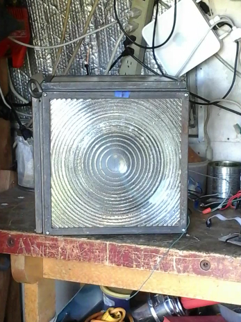
i stopped bringing any Fire to BinkyMan in 2007. i’m very pleased to have a chance to fire up an old project this weekend, “AF6MQ CWIR”. here’s the controls and solenoid on the bench all rewired and ready to be boxed. type a letter, and the flame will go “poof” in morse code. here’s a link to the original version for the crucibles legendary Fire Arts Festival (RIP).
and another try to link the youtubez….
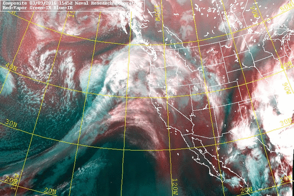
so who get’s to make up these names? Rivers all wind their own way to the sea. Vapor, what Atmos means in Latin, rises it’s way to the sky, then (hopefully) comes down as rain, to wind up in a river again, etc. etc. should be “vapor stream”, or “moisture channel”, “river” is for ground water mmkay? but even noaa is using it now. oh well. still pretty stuff (from NRL MRY, test of gify download), lined up pointing right at the bay, check ur galoshes and rain jackets, will be too windy for umbrellas.
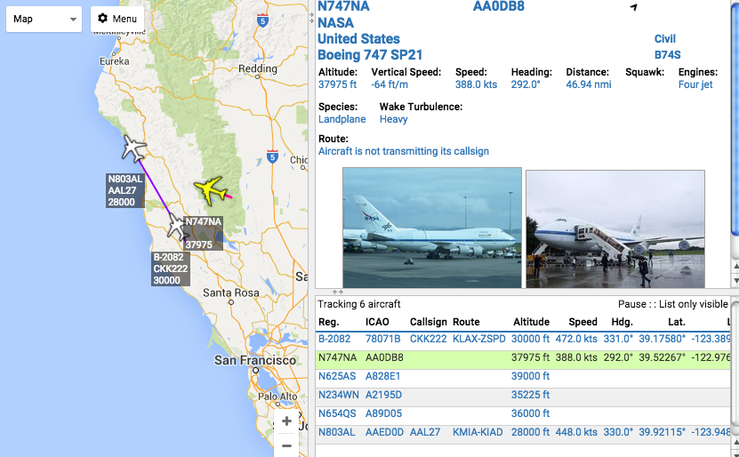
i’ve been wanting to do this for awhile, get some data on contrails/chemtrails. using dump1090 running on debian on an old laptop, and mono to run VirtualRadar, now have visual tracking of ADS-B pinging airplanes. next step, point the outside webcam to look at the sky, use motion to motion track, and log sky pics ref by the dump1090 tracking. there is real science behind contrails, it’s a pressure/temp/humidity thing, and i can cull that data online (winds aloft and radiosondes example).

do you believe in “chemtrails”?
what do you think they are spraying?
what do you think they are doing it for?
do you have any evidence for or against?
having a lot of fun watching the air traffic. i loaded dump1090 onto a debian machine, plugged in an RTL-SDR usb dongle, a hacked coax 1/4 wave vertical, and bam, we got all sorts of fun info about the planes flying over. here’s the raw dump from dump1090

then, using mono to run VirtualRadar, can see from other machines browser live updating with tracks, and net lookups of the tail numbers. i can only “see” about 10-30 miles out, so very lucky to be looking at it just the right time…..
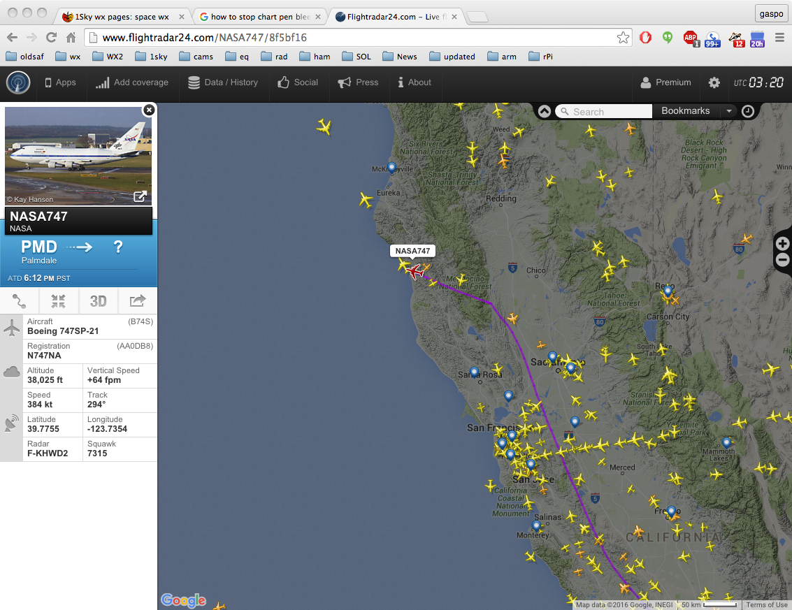
…..and then along comes SOFIA, the NASA flying telescope. Yes, they open a door on the side, the back section is de-pressurized, so to have a clear view of the heavens. the Ultimate Convertible, no?
and a double check against the pro’s,
so, who read all the way down here, and want’s to hear about the CHP Ghost C-130 flying circles over Folsom Lake?
yesterday it looked like we would get some good rain from some nice cold cloud tops.

NOAA 19 northbound 86W at 16 Feb 2016 22:09:52 GMT on 137.10MHz, HVC-precip enhancement, Normal projection, Channel A: 2 (near infrared), Channel B: 4 (thermal infrared)
but last night the fronts collided into the Cali Rex Block, and we barely got 1/8″ overnight.
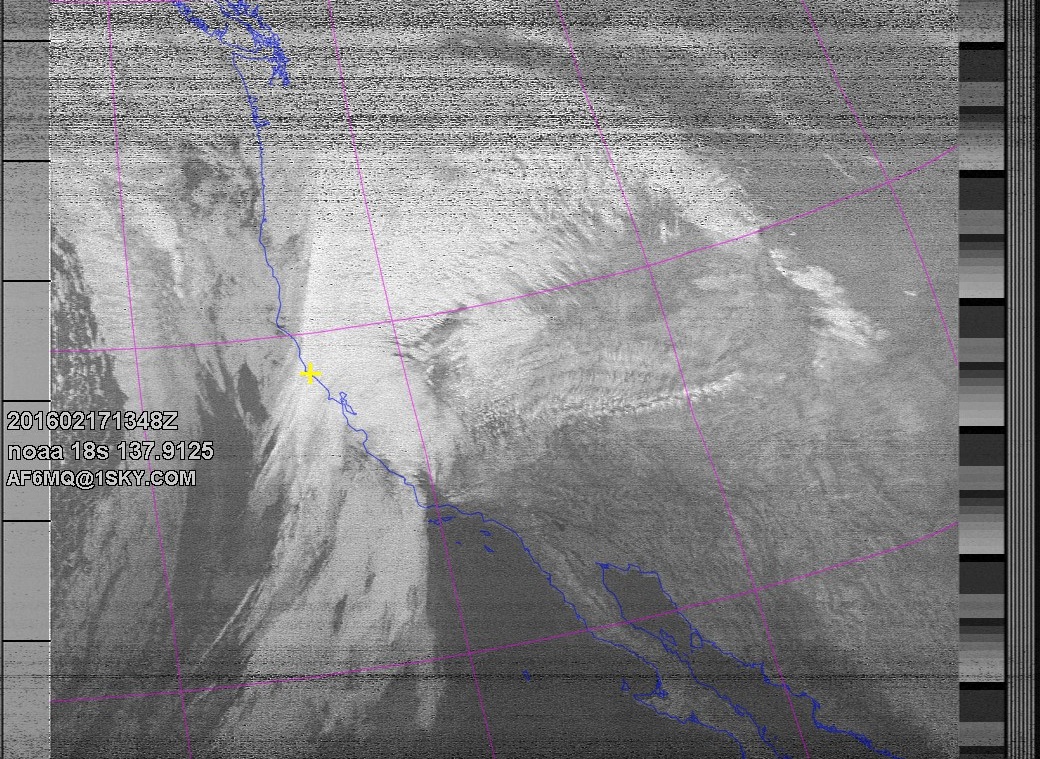
NOAA 18 southbound 49E at 17 Feb 2016 13:48:28 GMT on 137.9125MHz, contrast enhancement, Normal projection, Channel A: 3/3B (mid infrared), Channel B: 4 (thermal infrared)
The wind picked up to match the 15mb drop in 24hrs, and is still dropping today.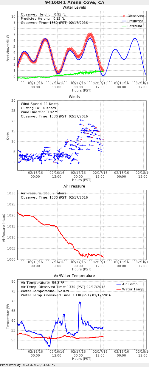
pray the second front will bring us more blessings of Rain !!!
quick little video of the DC3 new touch sensors in action. just a simple sensor-faceedges mapping for now to get the sensitivity dialed in. works about 1″ out from the face of the glass, and seems to be stable with power fluctuations thanks to extra regulator.
youtube link here
testing youtube embed here. Continue reading
soaring record temps across the western US, guess what kids, the Rex Block is Back. 2 incoming systems have bounced already, and looks like the next will have a hard time getting over the high pressure too.
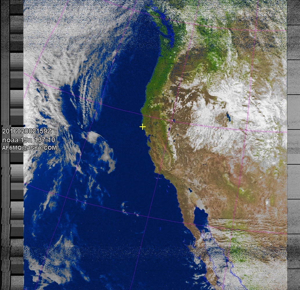
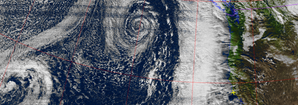
NOAA 19 northbound 79E at 08 Feb 2016 21:59:51 GMT on 137.10MHz, MSA enhancement, Normal projection, Channel A: 2 (near infrared), Channel B: 4 (thermal infrared)
the wrap around results in some serious vortex activity on the east coast, here can see the curve over washington state over B.C., dives back down into the midwest, and spills out over the atlantic, creating an intense low pressure spiral. That should have been rain for us, but the human heat is already summer levels.

even the big ships don’t scale well https://www.washingtonpost.com/news/capital-weather-gang/wp/2016/02/08/4000-passenger-cruise-ship-inexplicably-sails-into-atlantic-mega-storm/