WX setup

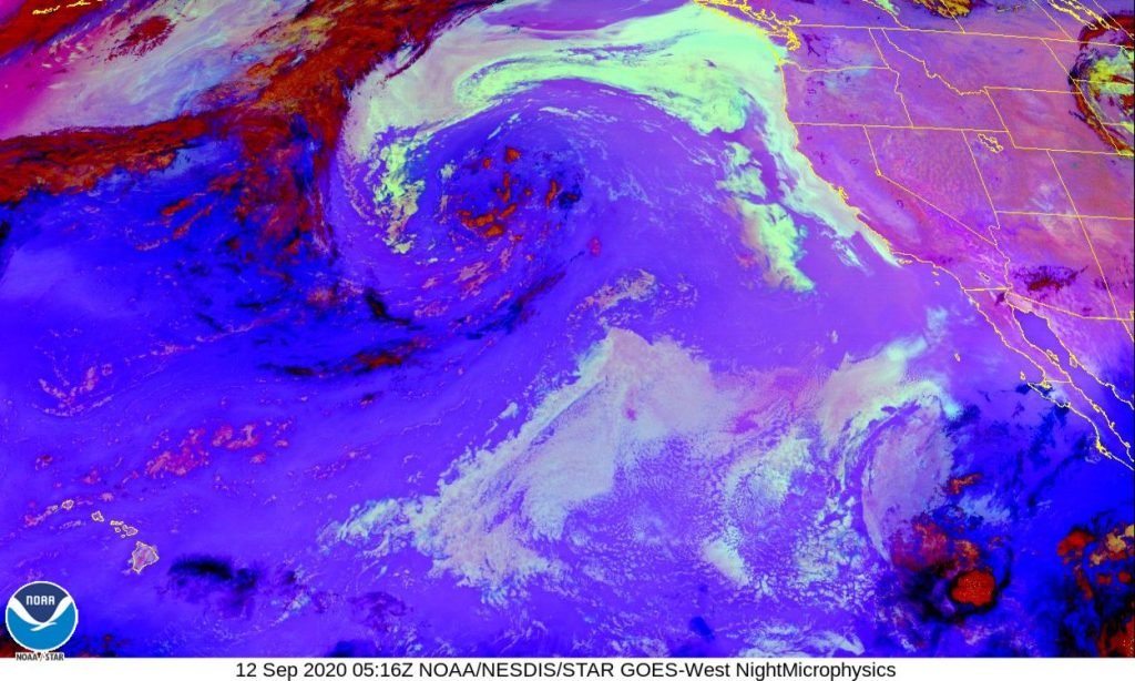
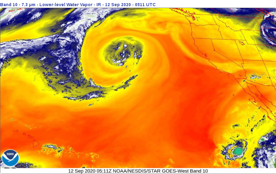
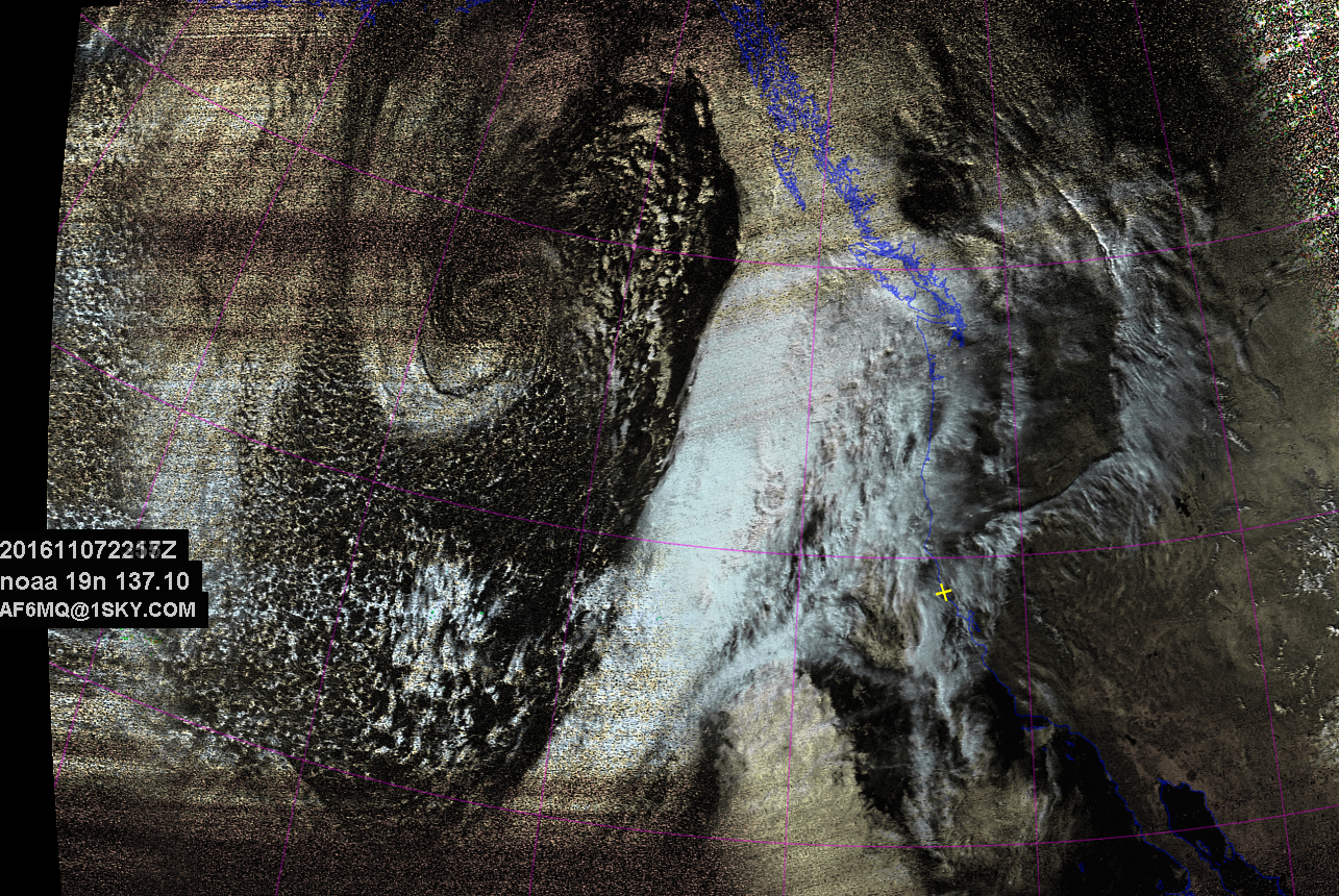
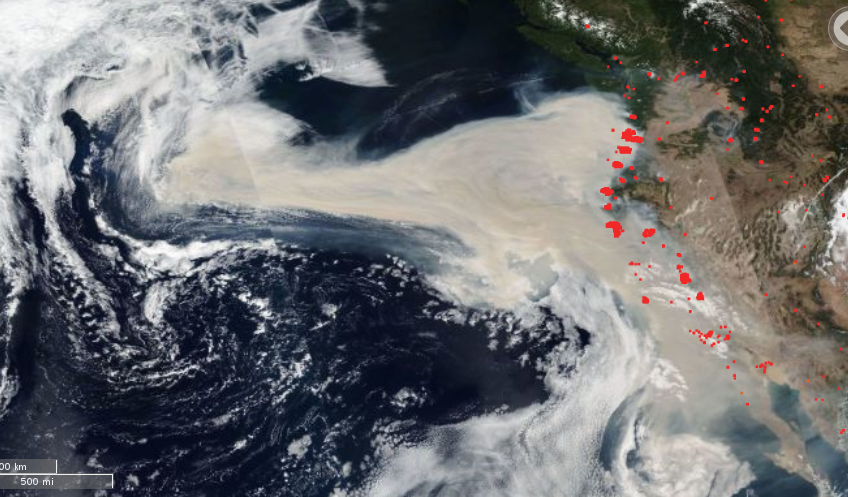
Cloud Seeding is the science of using particulate matter to induce water droplet formation in the atmosphere. ie, make it rain. solid fuel rockets spewing metal salt smoke have been used by the US and China with mixed success in weather modification. Smoke particles seed water droplet formation quite well due to their perfect size to stay airborne. Now smoke from the west coast fires has drifted west (contrary to normal pacific wind patterns) out to the cyclonic anomaly. we will see if this is a major rain event setup that would be welcome to put the fires out? or how about a west coast hurricane to stay with the 2020 apocalyptic theme?

from NASA FIRMS

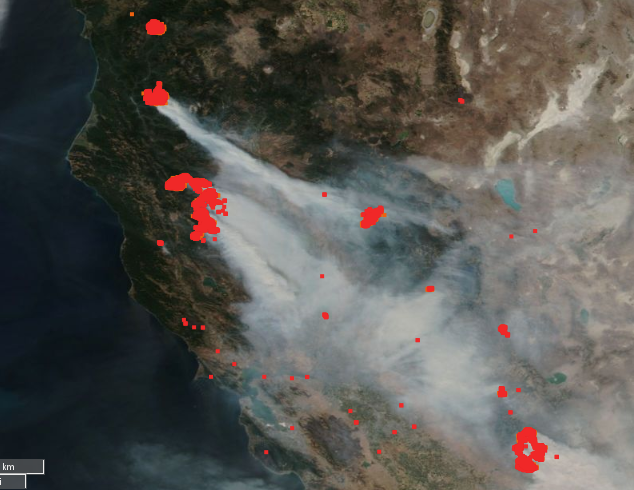
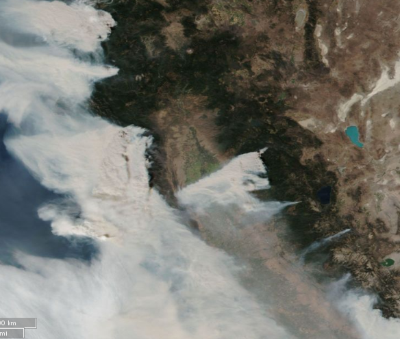
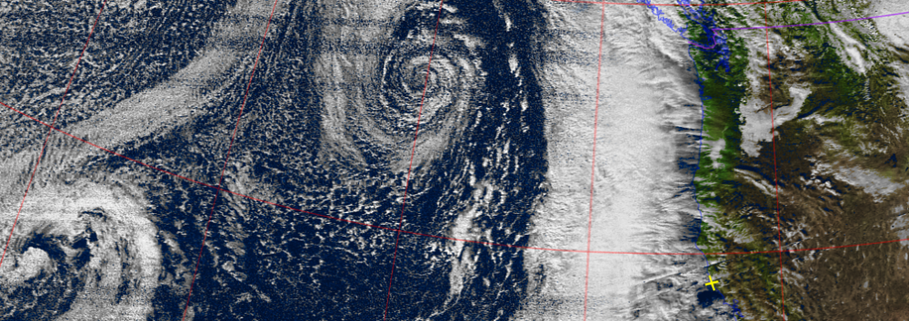
here’s a higher contrast view of the smoke

“Nighttime Microphysics” from NOAA GOES west cost sector
from NOAA GOES server direct link to my fav animation

moving day front

new camp site is just what i need for a couple months of re-fits and bolt downs for the big run.   fitting to my what-comes-next theory, a snappy cold wave pushed thru last nite.  last satellite pic from ridge camp was a clear one.  we’ll see how good reception is at the new site, moving the house trailer in the morning.

d1

movingday

santa screwed this year?

ya ever notice how an iced drink behaves on a hot day? the ice gets smaller sorta steady like,  then theres a pause, where the cubes are about 1/3 their starting size, and they don’t change size much for a bit.   then, suddenly they’re gone?  saw a version floating on the net without any attrib, so this version of the graph is direct from  NSIDC, the folks who actually count the icebergs.

figure2a

and why ? well it seems the ocean warming has warmed right up to the doorstep of the icepack, and the “plugs” in the straights aren’t forming.  see the really dark red spots in the bering straight? and like all from Greenland to russia?

figure-2b

don’t worry, Santa has water pontoons on the sled.

too bad for the reindeer tho,

http://rsbl.royalsocietypublishing.org/content/12/11/20160466

north_pole_cartoon


Perigee Moon Scores

SuperMoon.  harumph.  bullies shame the smart, and american schools teach to the lowest common denominator.  well, it ain’t common, it’s called “Perigee”, when the Moon is closest to Earth, as opposed to “Apogee” when it’s the furthest.  One of these days we’ll rid the earth of the last of the science shamers…

whatever, tide was SUPER LOW, and that is SCIENCE WIN!!!!

img_0431

img_0433


As Above…

traditional morse code goodbye is “73”.

that is –… …–  or dah-dah-di-di-dit di-di-dit-dah-dah.

say it fast.

nobody really knows the meaning, but the usage and rhythm i always think:

“As Above So Below”.

As Above,

20161107-n-noaa-19-hvc-precip

So Below

img_0425

tornado in oregon

ok, so that was a nice pressure drop, got 2 inches or more of rain here in the first band.  yeah, not wave, band.  like hurricane’s band up, so did this storm.  more coming, stay tuned.

                        SPC TORNADO AND SEVERE THUNDERSTORM REPORTS  
               UNOFFICIAL - FOR OFFICIAL REPORTS, SEE PUBLICATION 'STORM DATA'  
                    FOR 06CST FRI OCT 14  2016 THRU 16CST FRI OCT 14  2016  
    
      EVENT    LOCATION                       REMARKS                 (CST)TIME  
    
  .....TORNADO REPORTS..........TORNADO REPORTS..........TORNADO REPORTS.....  
    
   1 *TORN  MANZANITA OR      (31 S AST)                                14/0925  
            WATERSPOUT MOVED ONSHORE. REPORTS OF TORNADO   PQR/LSR   457212393  
                    DAMAGE IN MANZANITA. B  
   2 *TORN  OCEANSIDE OR      (48 S AST)                                14/1005  
            PER VIDEO OBTAINED VIA SOCIAL MEDIA...A        PQR/LSR   454712397  
                    WATERSPOUT FORMED OFF  


screen_shot_2016-10-14_at_103550_am-1476466581-8492

NOAA 19 northbound 39E at 14 Oct 2016 21:47:41 GMT on 137.10MHz, HVC-precip enhancement, Normal projection, Channel A: 2 (near infrared), Channel B: 4 (thermal infrared)

NOAA 19 northbound 39E at 14 Oct 2016 21:47:41 GMT on 137.10MHz, HVC-precip enhancement, Normal projection, Channel A: 2 (near infrared), Channel B: 4 (thermal infrared)

getting closer….

pressure holding steady, sunny HI holding on barely at the coast, still getting a bunch of wood split hoping for a few days of secluded rainy creative and accordion practice.

NOAA 19 northbound 62E at 12 Oct 2016 22:10:08 GMT on 137.10MHz, HVC-precip enhancement, Normal projection, Channel A: 2 (near infrared), Channel B: 4 (thermal infrared)

NOAA 19 northbound 62E at 12 Oct 2016 22:10:08 GMT on 137.10MHz, HVC-precip enhancement, Normal projection, Channel A: 2 (near infrared), Channel B: 4 (thermal infrared)

maybe rain?

signs pointing to some rain in the next days, fingers crossed, bellows squeezed….

NOAA 19 northbound 78E at 11 Oct 2016 22:21:26 GMT on 137.10MHz, HVC-precip enhancement, Normal projection, Channel A: 2 (near infrared), Channel B: 4 (thermal infrared)

NOAA 19 northbound 78E at 11 Oct 2016 22:21:26 GMT on 137.10MHz, HVC-precip enhancement, Normal projection, Channel A: 2 (near infrared), Channel B: 4 (thermal infrared)