noaa calls it an inside slider. i call it “australia cooled down revenge” from the winter we never really got. the garden calls it YummY.
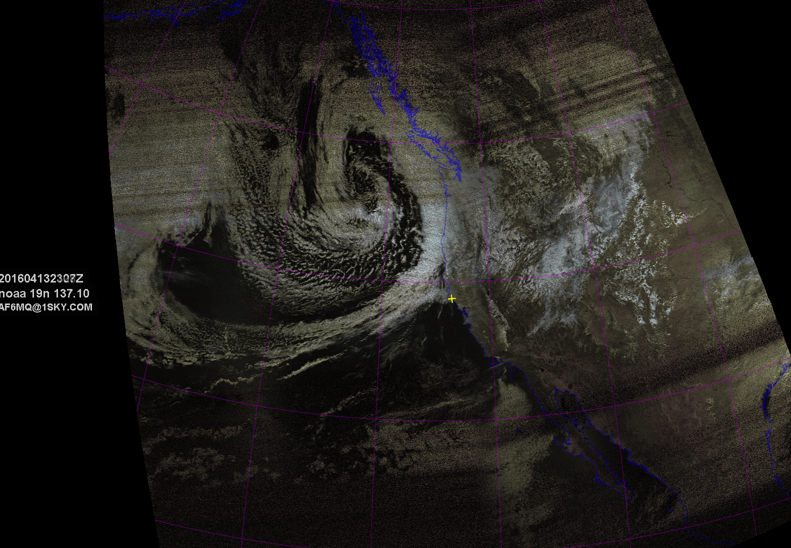
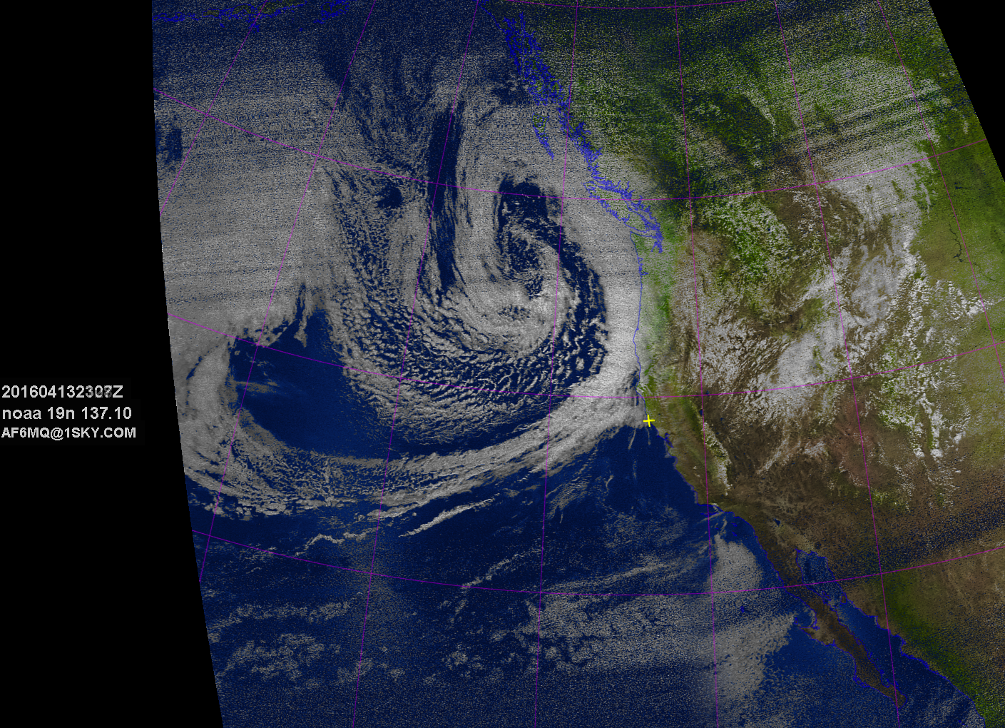
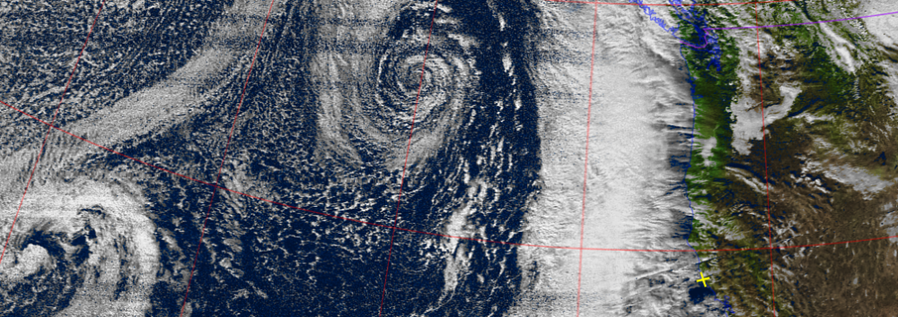
noaa calls it an inside slider. i call it “australia cooled down revenge” from the winter we never really got. the garden calls it YummY.
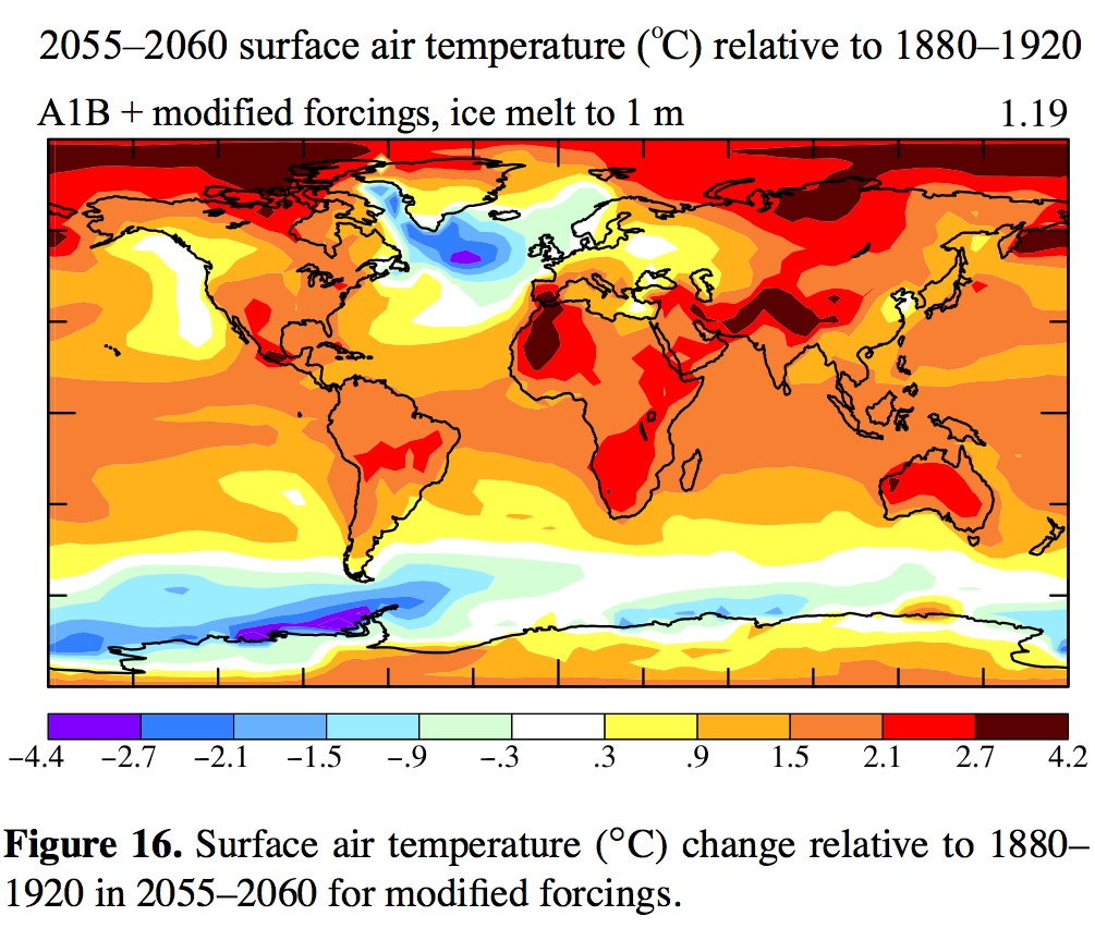
nice little bit of reading here on the climate change thing. i’ve said what Carl said, we’re doomed. this paper says 2055 gets interesting. NE conus and western europe get the big storms. excellent simulations with and without ice melt, etc. in sum: the hotter we make the planet, the bigger the storms will get. in science-speak,
Increased baroclinicity produced by a stronger tempera- ture gradient provides energy for more severe weather events. Many of the most significant and devastating storms in east- ern North America and western Europe, popularly known as superstorms, have been winter cyclonic storms, though sometimes occurring in late fall or early spring, that gener- ate near-hurricane-force winds and often large amounts of snowfall (Chapter 11, Hansen, 2009). Continued warming of low-latitude oceans in coming decades will provide a larger water vapor repository that can strengthen such storms. If this tropical warming is combined with a cooler North At- lantic Ocean from AMOC slowdown and an increase in mid- latitude eddy energy (Fig. 21), we can anticipate more se- vere baroclinic storms. Increased high pressure due to cooler high-latitude ocean (Fig. 20) can make blocking situations more extreme, with a steeper pressure gradient between the storm’s low-pressure center and the blocking high, thus driv- ing stronger North Atlantic storms.
the good news? their models agree with my theory that eastern pacific will maintain it’s temp. real estate potential, jes sayin…
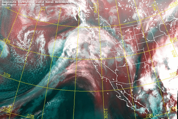
so who get’s to make up these names? Rivers all wind their own way to the sea. Vapor, what Atmos means in Latin, rises it’s way to the sky, then (hopefully) comes down as rain, to wind up in a river again, etc. etc. should be “vapor stream”, or “moisture channel”, “river” is for ground water mmkay? but even noaa is using it now. oh well. still pretty stuff (from NRL MRY, test of gify download), lined up pointing right at the bay, check ur galoshes and rain jackets, will be too windy for umbrellas.
i’ve been wanting to do this for awhile, get some data on contrails/chemtrails. using dump1090 running on debian on an old laptop, and mono to run VirtualRadar, now have visual tracking of ADS-B pinging airplanes. next step, point the outside webcam to look at the sky, use motion to motion track, and log sky pics ref by the dump1090 tracking. there is real science behind contrails, it’s a pressure/temp/humidity thing, and i can cull that data online (winds aloft and radiosondes example).

do you believe in “chemtrails”?
what do you think they are spraying?
what do you think they are doing it for?
do you have any evidence for or against?
yesterday it looked like we would get some good rain from some nice cold cloud tops.

NOAA 19 northbound 86W at 16 Feb 2016 22:09:52 GMT on 137.10MHz, HVC-precip enhancement, Normal projection, Channel A: 2 (near infrared), Channel B: 4 (thermal infrared)
but last night the fronts collided into the Cali Rex Block, and we barely got 1/8″ overnight.
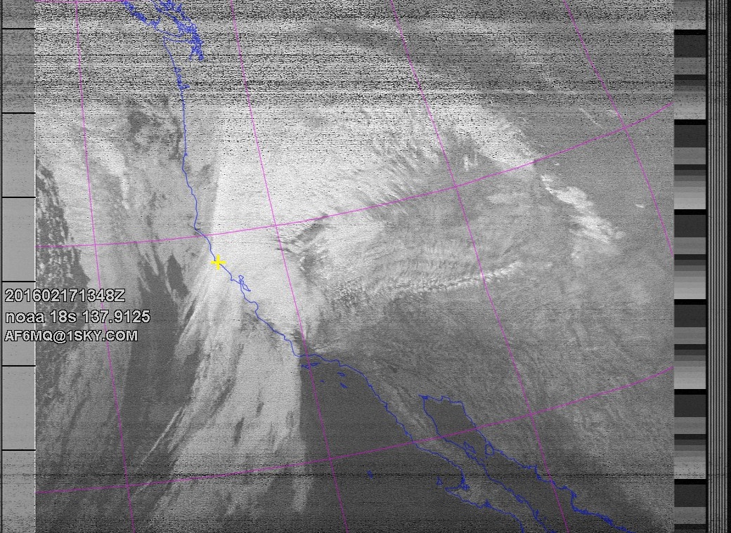
NOAA 18 southbound 49E at 17 Feb 2016 13:48:28 GMT on 137.9125MHz, contrast enhancement, Normal projection, Channel A: 3/3B (mid infrared), Channel B: 4 (thermal infrared)
The wind picked up to match the 15mb drop in 24hrs, and is still dropping today.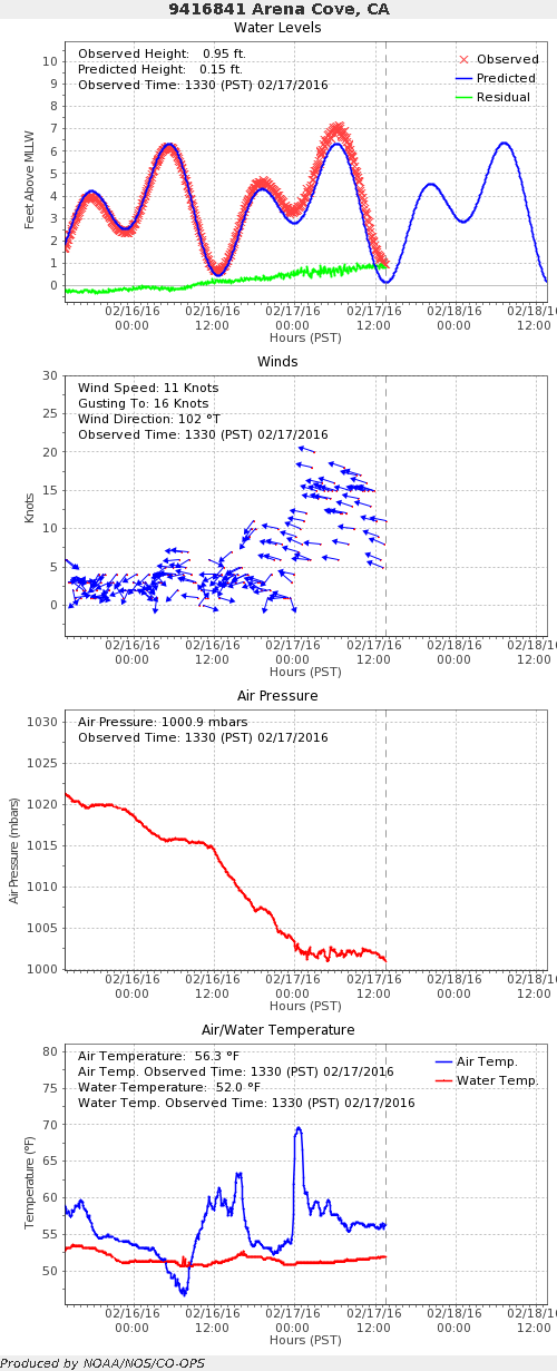
pray the second front will bring us more blessings of Rain !!!
soaring record temps across the western US, guess what kids, the Rex Block is Back. 2 incoming systems have bounced already, and looks like the next will have a hard time getting over the high pressure too.
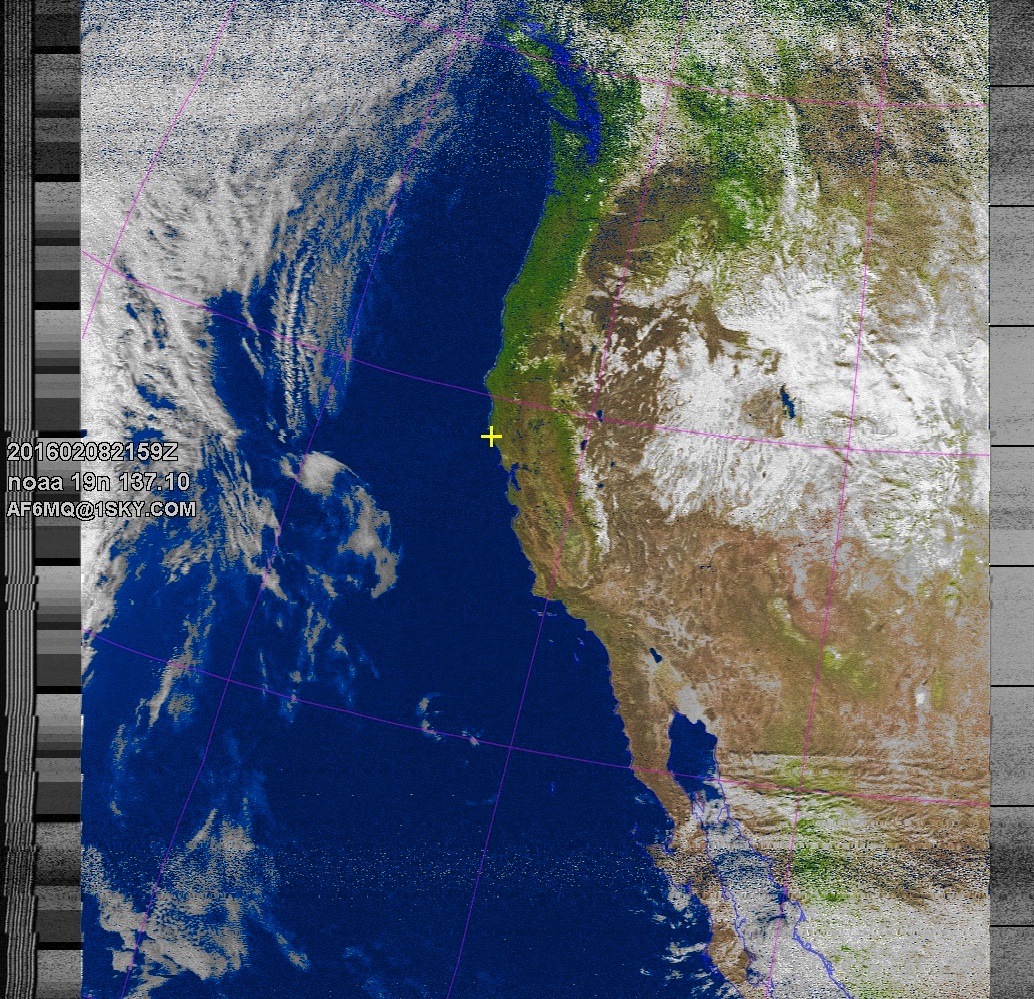
NOAA 19 northbound 79E at 08 Feb 2016 21:59:51 GMT on 137.10MHz, MSA enhancement, Normal projection, Channel A: 2 (near infrared), Channel B: 4 (thermal infrared)
the wrap around results in some serious vortex activity on the east coast, here can see the curve over washington state over B.C., dives back down into the midwest, and spills out over the atlantic, creating an intense low pressure spiral. That should have been rain for us, but the human heat is already summer levels.

even the big ships don’t scale well https://www.washingtonpost.com/news/capital-weather-gang/wp/2016/02/08/4000-passenger-cruise-ship-inexplicably-sails-into-atlantic-mega-storm/
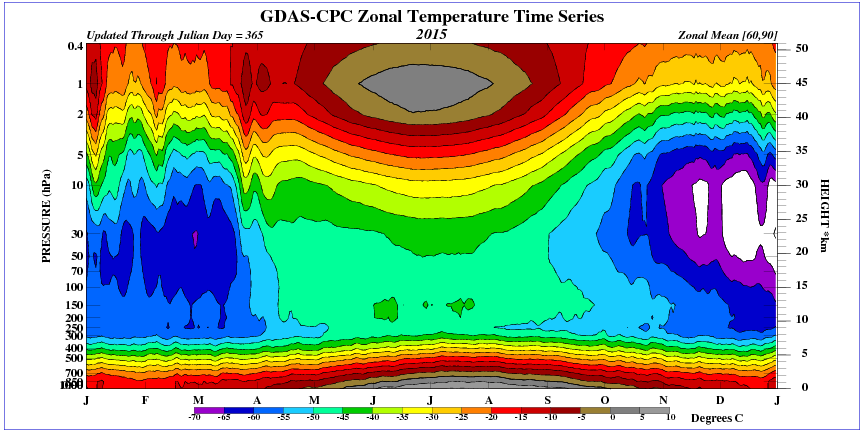
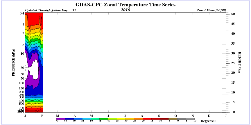
it is said that plants know the weather long before it happens. now we have science, so to see what it is they know. here is 2016 air temps so far, and last year 2015. notice the white (colder than 2015) upper air is warming up fast (er than 2015). my prediction, summer will be here by march. there may be another burst of upper cold or two before then, weather is never predictable, only observable.

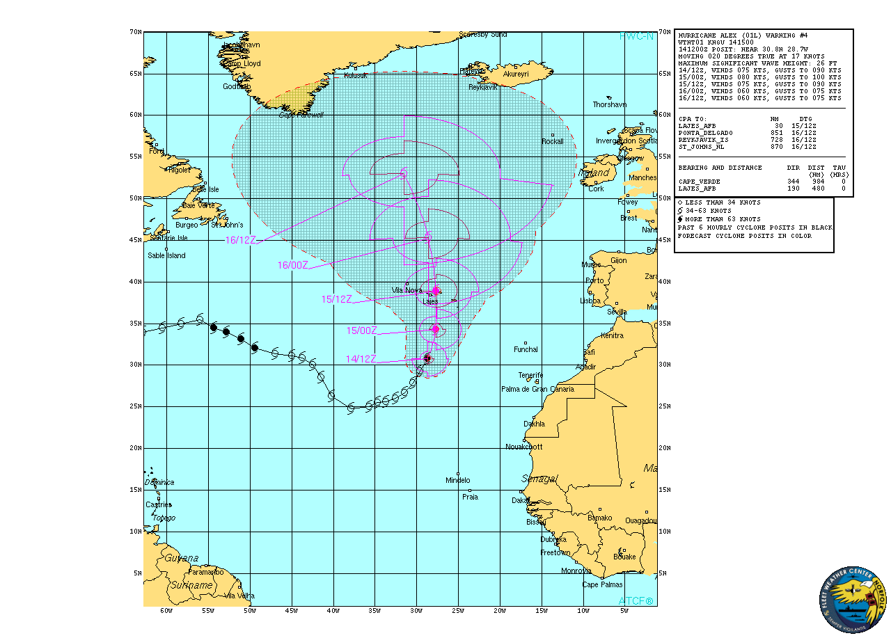
never seen this in my lifetime, a named atlantic hurricane in January.
totally fits with my theory, this is actually a spring storm, and since spring comes right after winter, but winter was only 2 weeks long, Alex is first spring ‘cane in my book.
from http://www.nrlmry.navy.mil/TC.html
spring is here. marigolds and daffodils are already at it.


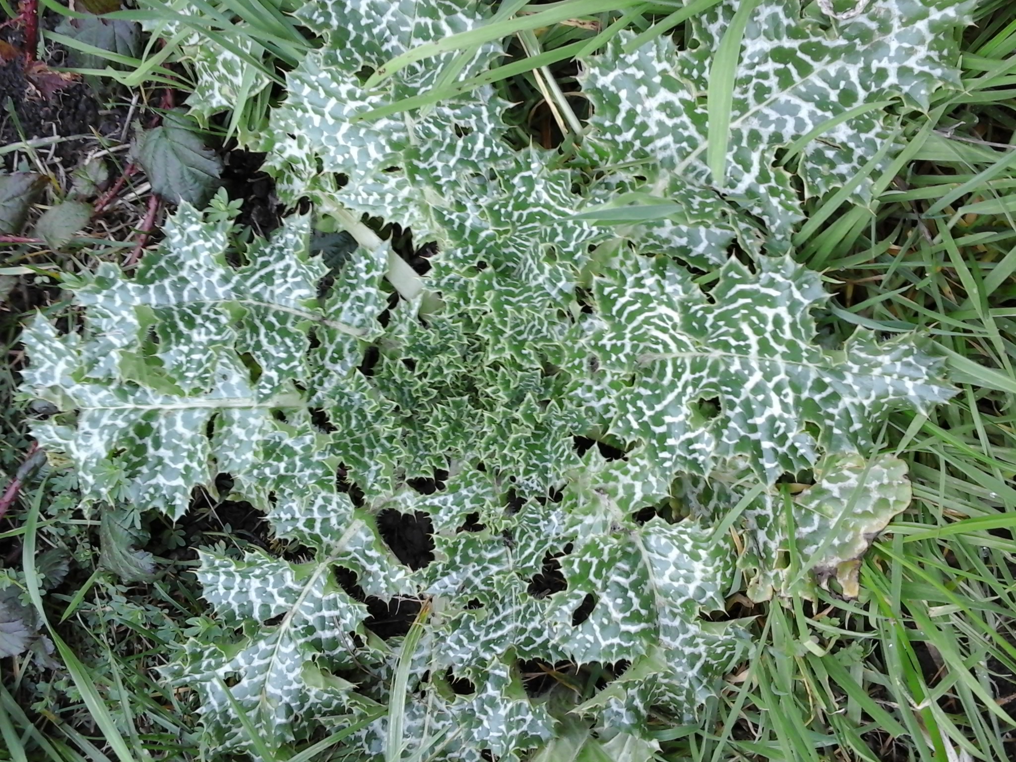
so who is good at plant identification?
is this milk thistle?
and what’s this one?

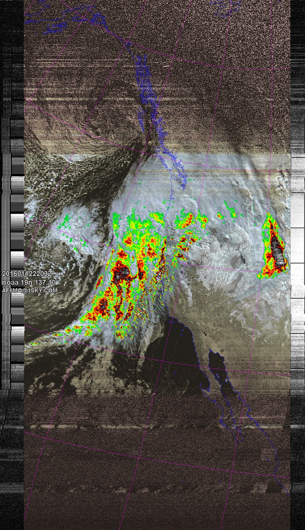
my satellite reception is plagued by noisy power lines nearby. but every so often, the pass times when the grow-lights up the road are not on, and the cloud tops are cold enough, that the color enhancement mode works. expect tornadoes when this upper level cold trough makes it over the ridges.
notice how the signal was clear enough only for 20-45 latitude. also of note, the system cloud line extends from well south into Baja, all the way north to Alaska.